Indochina
Now Vietnam occupies the entire east coast of Indochina. Its east ( Tokyo Bay ), southeast (South China Sea), and south ( Gulf of Thailand ) are all facing the ocean. The north is adjacent to China's Yunnan Province and Guangxi Zhuang Autonomous Region, and the west is Vietnam, Cambodia, Laos. is separated by the Changshan Mountains , the Red River Delta in the north, and the Mekong River Delta in the south.
The two deltas in the north and south of Vietnam
However, the territory of ancient Vietnam was not the same as it is today. Vietnam's current territory was established in the late 18th century.
Vietnam topographic map
一
The "dual-track movement" between the past and the reality of the countries in the Indochina Peninsula
It is not difficult to find the "double-track movement" between the past and the reality of the countries of the Indochina Peninsula. In the study of the history of the past hundred years, "history repeats itself" "On" is not a strange talk. In a sense, the United States' deeper and deeper involvement in Vietnam before 1975 was a historical echo of France's continued colonization of Indochina before 1954. However, the simple conclusion of "double tracks of past and reality" is far from being able to explain the complex history of Indochina.
Three Kingdoms of Indochina
In the 1970s and 1980s, the complex conflicts among the countries in Indochina had obvious historical origins, but they became more colorful due to the intervention of various ideologies. More importantly, the key decision-makers in those nation-states are no longer prepared to accept the roles that their countries have accepted in the past.
Take Vietnam as an example. Although there was still a clear pro-China tendency in the 1970s and it showed reasonable compliance, in 1979 Vietnam decided to get rid of the influence of China, its northern neighbor. The Khmer Rouge led by Pol Pot also refused to become the spokesperson of Vietnam's interests. After Vietnam and the United States signed a ceasefire agreement, the Khmer Rouge began to split with the Viet Cong. In addition, Vietnam has traditionally maintained its territorial control over Cambodia. The Vietnam invasion in 1979 was not unexpected at all.
Vietnam topographic map
Vietnam has a long history of interest in Laos, but an independent and complete Laos country emerged in the 1970s and 1980s. Although this regime was influenced by the Vietnamese, Laos is still the only country in the historical flood of the same era that is different from the past. The tributaries of rupture.
Vietnam
二
From the 10th century to the 14th century AD, Vietnam's southward movement was not smooth.
Through the above analysis, we can see that the three Indo-China countries, Vietnam, Laos and Cambodia, have still maintained their own characteristics in the evolution and development of history. Relatively unchanged characteristics, which just confirms those examples of "historical correspondence" that have been recorded in history books. However, some scholars do not agree with this view. They do not believe that Vietnam will be the main country causing tension in the Indo-China region in the future. The core question to answer this question is: Does Vietnam's past expansionism mean that it will be the main cause of trouble in the region today and in the future?
Vietnam's Southward Expansion
For a long period of history, Vietnam has always played the role of expansionist. This is beyond doubt. Today's Vietnam emerged in the core area of the Red River Delta. In various historical periods after the 10th century, Vietnam's territory expanded southward. In the early days, Vietnam's territory was mainly concentrated in the Red River Delta area, which is now the northern region of Vietnam. Vietnam's policy of southward expansion lasted for about 700 years. After the southward expansion, Vietnam's territorial area was approximately three times that of when it first became independent. After the late 18th century, Vietnam's territory remained basically unchanged.
In 939 AD Wu Quan became independent from the Southern Han Dynasty of China's Five Dynasties, and then Vietnam's power gradually expanded to the south. This "Southern March", or "Southern March", is very famous in history. It directly led to the war between the then Vietnam State and the Champa State affiliated to India. The Cham State at that time was located in today's Vietnam. In the central part of the country, the Cham people have no similarities with the Vietnamese in terms of race or culture. They can be said to be completely opposite.The civilization of the Cham people has many origins with India, and they are racially and linguistically similar to the residents of the Indonesian island. The completely disconnected cultures between Vietnam and Cham have aggravated the conflicts between the countries and the suffering caused by them. At the same time, it has also made the Vietnamese determined to destroy this southern enemy.
Map of Vietnam's 64 provinces
From its independence in the 10th century to the 14th century AD, due to the influence of various domestic factors such as the establishment of national governance institutions and water control, Vietnam's expansion was not able to continue smoothly in the early stages. The war with its southern neighbor occupying the city also has its own victory or defeat, and sometimes it advances and sometimes it retreats. Especially in the second half of the 14th century, the Vietnamese Chen Dynasty found it difficult to resist the attack on Champa. During this period, peaceful coexistence without war lasted for a relatively long time. Various exchanges such as transactions and personnel exchanges among the people gradually flourished, and cultures also influenced each other.
The process of destroying alien civilization has been delayed because of China. In the early 15th century, Zhu Di, the founder of the Ming Dynasty, raised 800,000 troops to conquer Vietnam, merged it into a province of the Ming Dynasty, and set up officials to rule it. The Ming Dynasty's invasion of Vietnam forced Vietnam to temporarily put its attack on Cham on hold, leaving it no time to consider expansion.
1630 Vietnam map
From the 10th century to the early 15th century AD, it was common for people to be captured to Vietnam for the purpose of using slave labor. This was a common practice in Southeast Asian societies with a sparse population at that time. In addition, Vietnam also plundered South China Sea products and gold and silver treasures from the Champa State, which was prospering in trade in the South China Sea at that time. In addition, Vietnam accepted its southwestern neighboring countries as tributary states and plundered wealth in the form of tribute.
Vietnam's territory expanded southward
三
Le Dynasty, and the "southern advance" began to be formalized.
The location map of Guluo City and several ancient capitals of world cultural heritage in Vietnam shows the outline of the migration of the Vietnamese dynasty's sphere of influence.
1427, Li Li established and then Li dynasty , and the "southern advance" began to be formalized. During the reign of Le Thanh Jong (1460-1497), the then capital of Champa, Vijaya (now Binh Dinh), was captured by the Vietnamese army in 1471. The Vietnamese army moved the capital of Champa to Xinzhou, which is today's Binh Dinh Province Quy Nhon. With the Cham in his pocket, the Cham kingdom embarked on the road to disintegration.
The weak and weak royal family of Champa was forced to move southward, and continued to survive in precarious conditions until the early 18th century. However, the fall of Xinzhou has opened the door of the Mekong Delta, and the Vietnamese can easily drive straight in.
The territory of Vietnam during the Nguyen Dynasty (this picture shows the north on the right and the south on the left. Recorded in Volume 1 of "Da Nan Yitong Zhi"
After the annexation of Champa, Vietnam's southward advance continued. From the 16th to the 17th century, due to Vietnam was divided internally (disputes between the Northern and Southern Dynasties and Zheng Nguyen). After the death of Shengzong in 1497, the centralized power system of the Later Le Dynasty began to collapse. In the second half of the 16th century, the real power was held by Lord Zheng in the north. and Hue's Nguyen Lord , the north and the south are in opposition, and disputes continue.
Vietnam to the South
For centuries, a distinctive feature of Vietnam's expansionism is that it is completely the result of official planning and the spontaneous consciousness of the people. To maintain their ever-advancing long southern border, the Vietnamese adopted military farming methods. These farmers who opened up wasteland for cultivation were always ready to obey military needs. At the same time, Vietnam's colonial expansion also gave those homeless people a way out. The poor at the bottom have no place in Vietnam's tightly controlled agricultural society. Although Vietnam's laws strictly control the population and do not allow people to move freely within the country, this slow but steady movement southward is still being suppressed with the flow of people. Reaching its climax, this flow of people migrating south played a very important role in Vietnam's expansion. By the early 17th century, Vietnam could no longer suppress its desire for expansion, and its power developed into the Mekong Delta region and extended its tentacles to the border. Cambodia's foreign power was gradually weakening.
The Nguyen regime in the Mekong Delta
began to actively expand its southern territory in the mid-17th century.The Nguyen family's regime expanded in the Indochina Peninsula. In the 18th year of Zhenghe (1697), it acquired the remaining land from the Champa people and established Binh Thuan Prefecture. The Champa Kingdom was destroyed.
warrior
四
Political marriage: Vietnam brought the Mekong Delta under its control
Chenla, which became a Vietnamese protectorate from 1818 to 1863, the area shaded by vertical lines is the county-based area, and the warm-toned areas outside the vertical lines are Vietnam and Siam Seeing
Compared with the glorious era of the Angkor Empire, Cambodia's national power in the 17th century was declining, but its territory included the Mekong Delta, which is the largest plain in Southeast Asia, with a total area of 44,000 square kilometers. Thailand, which prospered from the Chao Phraya Valley, became increasingly powerful and once included some territories formerly controlled by the Angkor Dynasty. When Vietnam invaded the Mekong Delta, Cambodia had to face threats from both the east and west. Therefore, in order to avoid fighting on two fronts and reduce Thailand's threat to Cambodia, Cambodian King Ji Zeta II decided to marry a Vietnamese princess with a good background.
A map of the Sino-Indian Peninsula in 1829. Vietnam is on the east coast of the peninsula. The seal on the map is the seal of the Nguyen Dynasty.
The price of this political marriage was that the princess obtained this coastal land from the king of Cambodia and allowed the Vietnamese people to Refugees entered Priyango to escape the civil war between the Northern Zheng Dynasty and the Southern Nguyen Dynasty during the Southern and Northern Dynasties of Vietnam. At the same time, more houses were built for the refugees to live. Since then, a large number of Vietnamese began to settle here. Priango later became known as Saigon , and is now even more famous as " Ho Chi Minh City ".
However, with the continuous influx of Vietnamese refugees, the declining Kingdom of Cambodia was unable to exercise effective jurisdiction, so the Mekong Delta became Vietnamese land and was called Saigon.
Vietnamese female soldiers
In the 19th year of Zhenghe (1698), Nguyen General Ruan Youjing seized the Mekong Delta under the jurisdiction of the Khmer and established Jiading Prefecture to rule it. Saigon (also known as Chaigun, today's Ho Chi Minh City) and other places entered Vietnam's territory . In 1708 (the tenth year of Yongsheng), Mo Jiu, the leader of the Khmer Kingdom of Ha Tien (now Kien Giang Province), surrendered to Lord Nguyen. By the end of the 18th century, the Mekong Delta and the southern states of Cambodia were encroached upon. Vietnam now accounts for four-fifths of the Mekong Delta, and Cambodia accounts for one-fifth.
At this point, after the current Vietnamese territory of expanded southward before the end of the 18th century, the large framework basically formed .
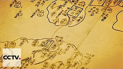
The map produced by the French at that time shows that there were a large number of Vietnamese place names in today's Laos. It can be seen that the south of Kamlu Prefecture, which is today's southern Laos and northeastern Cambodia
In 1859, France invaded the Mekong Delta. In 1862, France and Vietnam signed the first " In the Treaty of Saigon, Vietnam ceded the three provinces of Jiading, My Tho, Bien Hoa and Conlun Island to France. After that, France occupied the three provinces of Vinh Long, An Giang and Ha Tien in Vietnam and completely controlled the Mekong Delta region. Saigon became the capital of French colonial rule in Indochina. Saigon's social economy was influenced by France, and its commerce was extremely developed. It was a famous port and rice market in Southeast Asia, and was known as the "Paris of the East." After World War II, Saigon became the capital of South Vietnam. In 1975, Vietnam was unified and Saigon was renamed Ho Chi Minh City.
Saigon
From then on, the Mekong Delta region became the territory of Vietnam, and Ho Chi Minh City became Vietnam's economic center and the country's largest city, with a population of more than 12 million people.