1. The Age of Navigation

The Age of Navigation
Chinese maritime ancestors in prehistoric and ancient times established a network of connections between the mainland and the coast, between the coast and the islands, and between the islands through maritime transportation. They continue to advance towards the sea, contributing to the formation of the "Chinese Sea " marine cultural circle.
The Qin and Han Dynasties were an important period for the development of my country's maritime frontiers. Offshore fishing, sea salt production, and the development of sea routes have entered a new stage. In the book "Erya " written in the early Han Dynasty, the names of more than 20 kinds of fish were recorded, including five or six kinds of marine fish. The Eastern Han Dynasty Xu Shen's " Shuowen Jiezi " records the names of more than 70 kinds of fish, including ten or twenty kinds of marine fish. Have a certain understanding of wind, tides, maritime astronomy and meteorology, and also use the sun and Polaris as symbols for maritime navigation.
During the Western Han period, a route was opened from Xuwen via the South China Sea and the Indian Ocean to present-day southern India and Sri Lanka. People have been able to use the "heavy difference method" to accurately measure the topography and landforms of the seabed. Wang Chong of the Eastern Han Dynasty proposed in "Lunheng Shuxu" that "the rise and fall of the waves rise and fall with the moon", and discussed the relationship between the tide and the moon.
Li Chunfeng's "Island Actuarial" of the Tang Dynasty gave the method of calculating the height of the island and the distance from the ship, which had a profound impact on the surveying and mapping of later generations' navigation charts and the calculation of voyages. In the early Tang Dynasty, the "Guangzhou Tongyi Sea Link" was opened, and the ocean routes extended to the Persian Gulf and the east coast of Africa. Our country already had sounding equipment as late as the late Tang Dynasty. One type is "hook" sounding, and the other is "rope-tied iron" sounding. The depth can reach more than 60 feet.
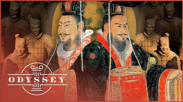
During the Five Dynasties and Ten Kingdoms period, the four countries of Wuyue, Fujian, Southern Han, Southern Tang along the southeast coast opened to the ocean. After the Song Dynasty, China's economic center of gravity shifted southward and eastward, and the southeastern coastal areas became the driving force for maritime development. The "Zheng He's Voyage to the Western Seas" that began in the third year of Yongle (1405) in the Ming Dynasty was the most open ocean management of the central government under the traditional dynastic system. The most detailed record of marine landforms is the "Zheng He Navigation Chart ", which accurately depicts 846 islands at home and abroad, and is divided into islands, islets, sand, shallows, ponds, harbors, reefs, reflections, rocks, gates, continents and other landform types.
Zheng He's Nautical Chart
China has long used wind as power and sails to aid navigation. During the Eastern Han Dynasty, there were written records of sailing using the monsoon. After the Tang and Song Dynasties, the use of monsoon navigation was very widespread. Zheng He's 47 voyages in the Ming Dynasty mostly took place in the winter and spring, using the northeast monsoon to set sail; and they mostly used the southwest monsoon to return in the summer and autumn. This shows that people at that time had fully understood and utilized the seasonal changes in wind direction and ocean currents in southern Asia and the northern Indian Ocean.
At the same time, in 1542 in the middle of the Ming Dynasty, Columbus was ordered by the King of Spain to cross the Atlantic and seek a way to India; in 1547, the Portuguese Da Gama led a fleet Around the Cape of Good Hope in Africa, northward along the Indian Ocean, arriving in India, the Eastern Route was opened.
In 1615, with the support of Spain, Magellan made a voyage around the earth. It took three years of arduous struggle, but he unfortunately died on an island in the Pacific Ocean, while his partner Carno completed the first voyage around the world. Facts have proved that the earth is a sphere, and the theory that the sky is round and the earth is round has finally been proven wrong.
In the fifteenth and sixteenth centuries, ships traveled far across the oceans, "discovered" North America, and South America, "toured" the coast of Africa, and "discovered" India and many other islands. Therefore, this period is called the great " geographical discovery " era, also known as the period of world travel activities. In fact, in the East, Chinese navigator Zheng He led a huge fleet to the Western Ocean seven times in the early 15th century. Its scale and majesty were unmatched by the era of the "Great Geographic Discovery".
The British passenger Kirk conducted three world voyages between 1768 and 1779. During the voyage, he had begun to pay attention to some scientific investigations related to navigation.During his first voyage, he traveled from Sydney to the Torres Strait area, measured water depth, water temperature, currents and winds, inspected coral reefs, and mapped the discovered islands and mainland coastlines, as well as the areas with water depth, currents, tides, and winds. Correct chart. However, purposeful marine scientific expeditions began with Challenger.
2. Scientific investigation period
"Beagle" ship
From 1831 to 1836, the British Darwin sailed on the "Beagle" ship, sailed in the southern hemisphere, and conducted geological and biological investigations. In 1859, he published " The book "The Origin of Species" mentioned the theory of biological evolution, triggering a huge revolution in biological science.
The "Challenger" was modified from a British warship with a load capacity of 2,000 tons. From December 1872 to May 1876, it lasted more than three years, cruising around the Pacific, Atlantic and Antarctic ice barriers, with a total voyage of 127,650 kilometers, and conducted bathymetry and biological collection at 362 points. It also measured the geomagnetic values of sea areas around the world; seafloor topography and seafloor geology; seasonal changes in deep ocean water temperature; and discovered the constancy of salt composition in the world's oceans (this is one of the most basic discoveries in oceanography ) ; Measured ocean currents, transparency, marine animals and plants, etc., laying the foundation for modern ocean physics, ocean chemistry, marine geology .
After the "Challenger" investigation report came out, it caused a stir in the scientific community at that time. It turns out that the ocean is far from monotonous and simple. This is a vast water realm that is moving and full of life. There are many secrets that have not been discovered by humans. Countries around the world are scrambling to follow suit, and marine surveys have sprung up like mushrooms after a spring rain.
From 1873 to 1875, the American "Tescarora" investigated water depth, water temperature, seabed sediments, etc. in the Pacific Ocean and discovered the Tuscarora Abyss ( part of the Japan Trench ).
From 1874 to 1876, the German "Antelope" conducted surveys focusing on ocean physics in the Atlantic and Pacific Oceans.
From 1877 to 1905, the American "Black" and "Albatross" conducted surveys focusing on plankton, benthic animals and coral reefs in the West Indies , the Indian Ocean, and the Pacific Ocean.
From 1885 to 1915, Monaco "Chirondre", "Princes Aris" and other ships from the equator to Arctic Circle Ocean physics and marine life of the Atlantic Ocean, Arctic Ocean , Mediterranean Sea Through observations, new marine organisms were discovered, a map of the surface currents of the Atlantic Ocean was obtained, the "World Bathymetric Chart" was published, and phenomena such as the flow of deep water from the Mediterranean Sea into the Atlantic Ocean were discovered.
From 1886 to 1889, the Russian "Warrior" surveyed the China Sea, Japan Sea, and Okhotsk Sea during its world voyage.
In 1889, the German "National" conducted a survey called "Plankton Expedition" in the North Atlantic . Hansen conducted a study on the vertical and horizontal distribution of plankton.
From 1893 to 1896, Norwegian Nansen took the "Fram" to conduct transverse and closed surveys in Greenland and the Arctic Ocean. The main findings were: (1) The phenomenon of dead water; (2) The wind current deviated 30 degrees to the right of the wind direction ~ 40 degrees; (3) describes the arctic sea current system, and its research results led to the emergence of the Ockman wind and current theory.
Although this period of oceanographic survey lasted only 20 years, important discoveries were made in various fields of oceanography, which greatly promoted the politics, military and economy of various countries at that time. At the same time, some problems existing in marine surveys were also exposed. For example: the surveys at that time were all carried out in a scattered manner, and the survey methods were not unified, which brought great difficulties to the exchange of marine data. Therefore, in 1901, the Nordic countries convened the International Council for Marine Research to study the issue of unified survey methods. Danish Koniusen made standard seawater for analyzing salinity, and with the help of Hansen and others, published Oceanography Commonly used tables.
At the same time, oceanographers have deeply realized that single-vessel traveling surveys are too backward: First, the survey capabilities of a single ship are limited, and it may take a long time to complete surveys of certain sea areas; for some sea areas, there are only a few months per year. There are sea conditions suitable for conducting marine surveys. Once this period is missed, the survey will be delayed. In multi-ship surveys, all ships in the survey area can conduct surveys at the same time, which can greatly shorten the time required for surveys and greatly increase the quantity and quality of survey data.
Secondly, the density of sampling points for single-ship surveys is limited, so small-scale hydrological phenomena may be "missed". For example, within a range of tens of kilometers, the flow direction may be completely opposite, and the currents also show considerable time changes. If the sampling points are too sparse, these hydrological phenomena may be ignored. For some large-scale short-term ocean hydrological phenomena, a single ship survey will show that the hydrological phenomena have changed before and after. The understanding of the ocean can only be obtained through pitifully little data and imagination. However, the world was in troubled times at that time, and it was not easy to unite multiple ships and countries. Only after the Second World War did joint investigations by multiple countries and ships become possible.
3. Multi-ship joint survey period
As early as 1950 to 1958, the Scripps Institution of Oceanography at the University of California in the United States initiated and hosted a series of surveys including the North Pacific , initially conducted by Peru and Canada. Participated, and later more than ten survey ships from the United States, Japan, and the Soviet Union participated.
The International Geophysical Year 1957~1958 and the International Geophysical Cooperation Joint Oceanographic Survey 1959~1962 were unprecedented in scale. The scope of the survey covered the world's oceans, with as many as 70 survey ships and more than 17 participating countries. .
By the 1960s, more and more countries were participating in joint marine surveys, including the International Indian Ocean Survey from 1960 to 1964, the International Equatorial Atlantic Cooperative Survey from 1963 to 1965, and the International Cooperative Survey of the Equatorial Atlantic from 1965 to 1970 (later extended to 1972). Kuroshio and its adjacent sea area cooperative survey, etc.
Among them, the International Indian Ocean Survey from 1960 to 1964 was initiated by UNESCO and involved 13 countries and 36 survey ships. It was the largest survey of the Indian Ocean to date. In 1955, the North Pacific Joint Survey Plan (codename: NORPAC) was initiated and hosted by the Scripps Institution of Oceanography at the University of California, USA. More than 10 survey ships from the United States, Japan, the Soviet Union, Canada and other countries participated. Due to the large number of participating survey ships, the time required to survey a sea area has been greatly shortened, the quantity of survey data has been greatly increased, and the quality of survey data has been improved. This joint investigation was the forerunner of a series of large-scale joint investigations that would follow.
In 1970, the former Soviet Union used dozens of data buoy stations and five or six survey ships equipped with the latest instruments to conduct surveys focusing on currents in the eastern Atlantic Ocean. Since the buoy arrays were arranged in a polygonal manner, this survey The code name is "Polygon". After more than half a year of observation, it was found that in this weak current area (average velocity is 1cm/s), there are mesoscale vortices with a speed of 10cm/s, a spatial scale of about 100km, and a time scale of several months.
This discovery immediately attracted the attention of the oceanographic community. From March to June 1973, 15 research institutes from the United States, Britain, and France used dozens of buoys, six survey ships, and two aircraft to form a joint observation network to observe a weak current area in the western North Atlantic. An ocean dynamics experiment code-named "MODE" was conducted in the area, and the observation results showed that mesoscale vortices also exist there.
The Sino-Japanese Kuroshio Cooperation Survey from 1986 to 1992 provided new insights into the source, path and hydrological structure of the Taiwan Warm Current and the Tsushima Warm Current, and made further progress in the ocean front , the path of the Kuroshio Current and the Great Bend. understanding.
After 1990, a world-wide ocean circulation survey, known as the "WOCE" project, was carried out. my country undertook a multidisciplinary comprehensive scientific survey of the vast western Pacific waters from 116°E to 141.5°E and 23°E to 3°S.
Tropical Ocean and Global Atmosphere-Tropical Western Pacific Sea-Atmosphere Coupling Response Experiment, also known as the "TOGA-COARE" survey, aims to understand the impact of the tropical western Pacific "warm pool area" on global climate change through air-sea coupling, thereby Further improve and improve global ocean and atmospheric system models. The intensive observation period was from November 1, 1992 to February 28, 1993, and four consecutive months of offshore field surveys were conducted in the tropical western Pacific warm pool area. 19 countries or regions participated in this event in different forms.
4. Three-dimensional ocean survey
Three-dimensional ocean survey
With the deepening of the understanding of the ocean, traditional observation methods are no longer able to effectively sample many important ocean processes on a spatial and temporal scale, and cannot conduct in-depth research. With the advancement of satellite remote sensing technology, hydroacoustic detection technology, radar detection technology, various observation platform technologies, sensor technology, communication technology (including hydroacoustic communication technology) and underwater networking technology, ocean observation technology is moving towards automatic, The direction of real-time, synchronous, long-term continuous observation and multi-platform integration, multi-scale, high-resolution observation has been developed to form three-dimensional observation from space, water surface, coast, underwater, seabed .
(The article is excerpted from "Marine Survey Methods" published by Ocean University of China Press, and the pictures are from the Internet)