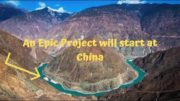
The North Tibetan Water Diversion Project is a giant project envisioned by the Chinese people. Its purpose is to transfer water from the Brahmaputra River to the northwest. Currently, the most widely circulated plan on the Internet is the "Red Flag River" plan. However, this plan lacks basic common sense and is impossible to implement.
First of all, the plan mentioned that it can achieve self-flow throughout the entire process. However, the altitude at the big bend of the Yarlung Zangbo River is only more than 100 meters. How can it self-flow to Xinjiang, which is more than 2,000 meters above sea level? Secondly, the plan has to pass through the Hengduan Mountains with crisscrossed ravines and cross grand canyons such as the Nu River, Lancang River , Jinsha River , and it is impossible to build canals along the mountains here.

The terrain of the Hengduan Mountains
So how should this route be taken? Let’s first understand the Brahmaputra River. The Brahmaputra River is more than 2,000 kilometers long and is the river with the highest average altitude in the world. The river is divided into three sections: the upper reaches, the middle reaches and the lower reaches. The altitude of the upper reaches is between 4530 and 5590 meters. The altitude of the middle reaches (from Rizi to Paizhen, Milin County) is between 4600 and 2800 meters. The altitude of the lower reaches is between 4600 and 2800 meters. Rapidly descending from 2800 meters to 115 meters.
Schematic diagram of the Brahmaputra River
The upper and middle reaches of the Brahmaputra River occupy more than 1,500 kilometers in length, but its annual runoff is negligible. Although the downstream section is shorter, it is a windward outlet with very abundant rainfall, causing the water volume of Yajiang to increase sharply. The annual average flow of the Yajiang River in the downstream section reaches approximately 4,425 cubic meters/second, second only to the Yangtze River and Pearl River . The water energy resources contained here are nearly 100 million kilowatts, second only to the Yangtze River.
Therefore, to adjust the water in the Yajiang River, it must be transferred from the downstream. There is almost no water in the upstream. The lowest altitude at Big Bend is more than 100 meters. How can we transfer water from such a low altitude to a higher altitude? There is only one answer, pumping. The current submersible pump can raise water up to 500 meters. Only a few more transfer reservoirs need to be built to transfer water to higher altitudes.
Yarlung Zangbo Grand Canyon
Considering the topography of the Tibetan Plateau , this water diversion line must not be taken from the Hengduan Mountains, so it can only be taken in the direction of the Northern Tibetan Plateau . The Northern Tibetan Plateau, also known as the Qiangtang Plateau , has an average altitude of over 4,000 meters. The internal geographical environment is relatively closed and surrounded by mountains. Therefore, the interior of the Northern Tibetan Plateau is an internal flow environment, with a large number of internal flow rivers and lakes. In fact, in ancient times, the Northern Tibetan Plateau was a large lake, which can be said to be the largest large lake with the highest altitude in China.
If the water of the Brahmaputra River can be transferred to the northern Tibetan Plateau, then the northern Tibetan Plateau will become the highest large reservoir in China. Water is transferred from the Northern Tibetan Plateau to the Sanjiangyuan, Qaidam Basin and Tarim Basin, all of which are located at high altitudes and can form artesian flows. The internal terrain of the Northern Tibetan Plateau is also relatively flat, which is conducive to the construction of large machinery and the laying of pipelines.
Therefore, the most critical problem is how to mobilize the water of the Brahmaputra River to the northern Tibetan Plateau. In fact, we can once again utilize the middle and upper reaches of the Brahmaputra River. We can build many stepped dams on the Brahmaputra River, which can generate electricity on one side and store water on the other. Then, submersible pumps are used to pump the water in the Big Bend area through multi-stage dams to the middle reaches. In the middle reaches, the dam altitude can be increased to 4,500 meters, which has exceeded the average altitude of the northern Tibetan Plateau.
In this way, the water of the Brahmaputra River can be mobilized to the middle and upper reaches with the minimum amount of engineering work, and then transported to the northern Tibetan Plateau. The large and small hydropower stations built on the Brahmaputra River can provide power for pumping water. In addition, the construction of a large number of dams has given the Yarlung Zangbo River a "high gorge and flat lake" landscape, and navigation along the coast has greatly improved the transportation conditions in Tibet from east to west and is conducive to promoting the development of Tibet's economy.
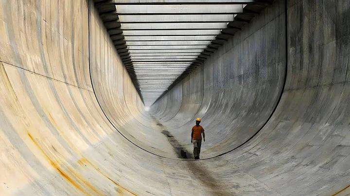
Then, pipelines were laid on the northern Tibetan Plateau to transport the water from the Brahmaputra River to the Sanjiangyuan area.From the northern Tibetan Plateau to the source of the Sanjiang River, you need to cross the Tanggula Mountain. Since the mountain is over 5,000 meters above sea level, it is recommended to dig a tunnel and lay the pipeline in the tunnel. The average altitude of the Sanjiangyuan is 4,000 meters, slightly lower than the Northern Tibetan Plateau. As long as the tunnel location is properly selected, artesian flow from the northern Tibetan Plateau to the source of the Sanjiang River can be achieved.
Since it passes through the Sanjiangyuan, it can replenish water for the Yellow River here, thus reducing a lot of engineering work. Subsequently, the water from the Yajiang River was transferred through pipelines to the Qaidam Basin at an altitude of about 3,000 meters. The route needed to pass through the gap between the Bayan Har Mountain and the Kunlun Mountain. The altitude here is relatively low, so the adjustment Water difficulty is relatively low.
As long as the water from the Brahmaputra River is mobilized to the Qaidam Basin, the entire project will be successful. Because the Qaidam Basin is the highest basin in China, through this place, the river can flow to the Tarim Basin, thereby controlling the entire Taklimakan Desert . In addition, through certain water diversion projects, water can be transferred to the upper reaches of weak water to provide water sources for Hexi Corridor and Alxa Plateau.
If this project is realized, the water shortage problem in the northwest region will be alleviated. A large amount of water sources are input to the Tarim Basin and Alxa Plateau, where drip irrigation agriculture will be developed on a large scale, causing the desert area to decrease rapidly. In this way, China's largest desert will completely turn into an oasis. In this way, China's cultivated land area has further expanded, and food security has been further guaranteed.